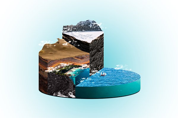
Geophysics
%20(3)%20mountains-542971.jpg)
The Earth is a living planet and geophysics studies the physical properties and processes of the Earth. It is an interdisciplinary branch that combines knowledge from geology, physics, chemistry, and mathematics to understand and explore different aspects of the Earth. Geophysics is used to study the Earth's internal structure, its surface properties, and various geophysical processes that affect the planet.
Description
The Earth is constantly being reshaped by the active processes taking place in its interior. Geophysics seeks to understand the history and structure of the Earth. We want to know what drives the processes in the Earth's interior and through advanced measurements we can see what the Earth looks like inside from the crust, through the mantle down to the core.
The Swedish National Seismic Network (SNSN) analyzes earthquakes both in Sweden and abroad. Follow updates in real time.
Our Research
Mountain building
Mountain belts are one of the major features on the Earth's surface and have a profound influence on its inhabitants and their ways of living, amongst others by affecting climate and weather and providing attractive and unique habitats. At the same time, mountain belts are prone to natural disasters like earthquakes, landslides and floods. Mountain belts, or their remains, tell us also about how planet Earth developed under much of its long history. To research their distribution over time and the processes that act under their development is a multidisciplinary endeavour.
Research on mountain building at Uppsala University deals with Scandinavian and Arctic mountain belts as old as 2 billion years, but presently with a strong focus on the c. 400-million-year-old and deeply eroded Scandinavian Caledonides. Applied geophysical methods like reflection seismics, magnetotellurics and potential field measurements allow us to explore and model the subsurface, the latter in close collaboration with geological and rock physics research on the character of the rocks at the surface.
The flagship project is the Collisional Orogeny in the Scandinavian Caledonides (COSC) scientific drilling project, supported by the International Continental Scientific Drilling Program (ICDP). In this project, an international science team performs mountain building research on two fully cored boreholes of about 2.5 km depth (drilled in 2014 and 2020, respectively) that together sample a key-section through a major, "Himalaya-sized" Paleozoic mountain belt.
For more information on COSC, please refer to:
- International Continental Scientific Drilling Program(ICDP): COSC-1 and COSC-2
- COSC på Facebook
%20(2)%20norway-4970019.norgeberg.jpg)
Earthquake seismology
Earthquake seismology at Uppsala University has a long history which goes back to the installation of the first Nordic seismograph in 1904. Professor Markus Båth built a national seismic network and developed earthquake analysis to a world leading position. Today, the Department of Earth Sciences maintains the Swedish National Seismic Network (SNSN) used to analyze earthquakes in Sweden and worldwide with 67 state-of-the-art seismographs. Earthquake research at the Geophysics programme is to a large extent data driven and focuses on methodological development and specific geological targets. We have developed the data acquisition and analysis systems used in the Swedish and Icelandic seismic networks (the SIL-system), which very successfully detects and analyses microearthquakes to below magnitude 0. The locations, focal mechanisms and underlying stress states are analyzed to understand why the earthquakes occur where they do. We investigate structures in the crust and mantle using various methods developed within areas of seismic tomography and surface-wave analysis, among other, in order to understand processes such as mountain building and volcano development. In Sweden, our earthquake research focuses on understanding the mechanism of large end-glacial earthquakes (see photo) that occurred in northern Fennoscandia at the end of the last Ice Age, investigating mechanisms of current intra-plate seismicity and structure of the crust and upper mantle of the Fennoscandian Shield to understand its evolution through the past billions of years. In Iceland we participate in research on understanding and monitoring volcanoes, analyzing earthquakes which occur in geothermal systems and understanding the triggering of earthquakes during geothermal energy extraction.
%20(6)%20marrakesh-city-after-earthquake.Bingimage.freepik.jpg)
Lithosphere Geophysics
The Geophysics programme at Uppsala University has a long history and strong current research focus within lithosphere geophysics. The lithosphere forms the plates that “float” and move on top of the deeper, more viscous convecting mantle driven by plate tectonics. The lithosphere is made up of two main, chemically different layers, which are chemically different, the crust at the top and the mantle lithosphere at the bottom and exhibits a long-lasting archive of past geodynamic history.
Chemical, structural and thermal changes within the lithosphere affect the physical properties of rocks, such as density, magnetic properties, and the speed of seismic waves passing through the medium. We use various geophysical methods to detect, model and image these variations in physical properties – the lithospheric structure. From these studies, we can make implications on composition, thermal state and past and current geodynamic processes [link to geodynamics] of Earth. At Uppsala we have a clear focus on seismological and electromagnetic techniques [link to EM], but we also use gravity and magnetic techniques as supporting tools.
We currently have projects across the globe, with many applications including studies in Scandinavia, the Alps, Central-and Eastern Europe, the Arctic, Greenland, Iceland, Brazil, the middle East, China and others.
%20(2)%204200.1800.Island.jpg)
Scientific drilling
Rocks and sediments on continents and in ocean basins provide a record of the development of planet Earth. Knowledge about the history of planet Earth is important for our civilization, amongst others for the sustainable development of natural resources, the knowledge about the climate on different time-scales, how dynamic processes in the Earth's crust can lead to natural disasters and about the nature of ecosystems and how they are affected by human activities. In addition, the knowledge is important for extraction of the necessary resources in a manner which minimizes the environmental impact on our planet.
Geoscientific information from the underground is expensive and drilling is often the only way to obtain samples and in-situ measurements. Since drilling on continents and oceans requires advanced infrastructure, two major international scientific programmes were developed to support scientific drilling, the International Continental Scientific Drilling Program (ICDP) and the International Ocean Discovery Program (IODP). Sweden is a member in both programmes and national interests are coordinated in the Swedish Scientific Drilling Program (Swedish Scientific Drilling Program SSDP, before SDDP) at Uppsala University. SSDP supports Swedish researchers who have an interest in scientific drilling and helps with the development and conduction of scientific drilling projects. Furthermore, Sweden features a national research infrastructure for scientific drilling. “Riksriggen” (www.riksriggen.se) is a versatile platform for multidisciplinary subsurface research that serves the Swedish and international drilling community through the entire life-cycle of scientific drilling. It has a capacity to conduct core drilling, borehole measurements and in-site stress measurements to a depth of 2.5 km.
A scientific drilling project that is led by researchers at Uppsala University is Collisional Orogeny in the Scandinavian Caledonides (COSC). The main target of COSC is to study mountain building processes in major orogens, like the Himalayas. These processes are active tens of kilometres below the surface, and their expression (e.g. the Tibetan Plateau) and consequences (e.g. earthquakes and other natural disasters) affect millions of people. Unfortunately, it is not possible to study these deep processes directly in a modern mountain belt (orogen). The Caledonian mountain belt was similar in size to today's Himalayas about 400 million years ago, and has been deeply eroded since then. Rocks that were deformed at mid-crustal level during Caledonian orogeny are now exposed at the surface. COSC studies a key-area of the Caledonides that is located in the Scandinavian mountains of Jämtland, Sweden, with the aim to compare traces after “fossil” processes with knowledge from major modern mountain chains like the Himalayas, to further our understanding on how orogens develop and how mountain building changed over time. Two drill holes to ca. 2.5 km depth provide a near-continuous sample (drill core) and, thus, profile through a part of the mountain chain that was transported several hundreds of kilometres onto the Fennoscandian Shield. During 2014, we successfully drilled the first borehole, COSC-1 near Åre, with financing from ICDP and the Swedish Research Council (VR). The second borehole, COSC-2 near Järpen-Mörsil (Jämtland), was drilled in 2020 to c. 2.3 km. COSC is an international project with about 50 participating researchers from more than 10 countries. It is led by researchers at the geophysics programme at Uppsala University. COSC research is much wider than mountain building. Researchers are concerned, amongst others, with physical rock properties, they model the groundwater flow and how it affects the heat transport in the rock. The steady state temperature profile in the boreholes can be used to reconstruct the development of the surface temperature for the last 100000 years. Microbiologists study the deep biosphere, i.e. microbes that live in this special environment at depth.
FIXA DETTA!!!
- The Swedish Scientific Drilling Program (SSDP)
- International Continental Scientific Drilling Program (ICDP)
- International Ocean Discovery Program (IODP)
- European Consortium for Ocean Research Drilling (ECORD)- member of IODP
- Collisional Orogeny in the Scandinavian Caledonides (COSC)
Volcanoseismology
Geophysical methods are fundamental in the monitoring of volcanoes and can provide important insights into how a volcano works. This is partly to know if an eruption is imminent, but also what character an eruption may take so that warnings can be issued in time and reasonable measures be taken depending on distance from the volcano. This is possible because a volcanic eruption usually, but not always, is preceded by “unusual” activity prior to an eruption. The volcano may, e.g., "inflate" because the amount of magma or gas increases in the system underneath the volcano (e.g. in a shallow magma chamber), or seismic activity (earthquakes or continuous tremor) may increase when magma intrudes into it. If the precision of earthquake or tremor locations is high enough, one may follow magma movements, and thus know where in the volcanic system an eruption is likely to occur. Various geophysical methods can also be used to image volcano interiors. Here, at the geophysics program, we work primarily with seismological methods, but also electromagnetic ones, in order to image the volcano's interior. Interpretation of our images is done in close collaboration with geologists and volcanologists, both here and at other universities, to enhance our understanding of volcanic processes and provide context for the interpretation of activity. We also work with and develop systems for registering and locating earthquakes in near real time.
Contact persons: Ari Tryggvason, Olafur Gudmundsson, Björn Lund
%20(2)%204200.1800.K%C4%ABlauea.jpg)
Applied Geophysics
Applied Geophysics covers a broad range of applications and methods related to exploration, site characterization, cavity detection, environmental problems and much more. Exploration can be for petroleum, minerals, groundwater and other resources of economic value. The scale of the target that the experiments are conducted over may vary from tens of kilometers to determine crustal thickness to a few meters to find a buried pipe. All types of geophysical techniques are employed, including seismic, magnetic, gravimetric, electrical, electromagnetic (EM) and radiometric ones.
Examples of ongoing research in applied geophysics at the Geophysics Program include improving hard rock seismic processing methods, characterization and monitoring of carbon dioxide storage sites, development of EM instrumentation and interpretation methods, borehole logging for rock properties, and development of new seismic acquisition methods. This work is generally of societal importance, but there are also many components of basic research within the activities. One example of this is using geophysics to better understand the geological history of the Scandinavian mountain belt by "looking" into its structure down to depths of tens of kilometers.

Geomagnetism, Paleomagnetism and Rock Magnetism
The geomagnetic field is a persistent feature throughout much of Earth’s past. Its presence enables habitability of the planet, deflecting harmful Solar energetic particles and limiting erosion of the atmosphere. Humans have used the magnetic field for navigation for more than two thousand years. Some animals and bacteria also use the magnetic field for navigation purposes, a trait that has an evolutionary origin. To large extent the field appears as a magnetic dipole, similar to that of a regular permanent magnet. The magnetic field originates from convective and turbulent flow of metallic liquid in the outer core, which is known as the geodynamo. The magnetic properties of sediments and rocks can provide quantitative information on the inclination, declination and intensity of the past geomagnetic field. This information can be used to study the past movement of tectonic plates, a discipline which is part of paleogeography. Measurements of these properties also provide the possibility to study the development of the magnetic field.
The Geophysics research program co-leads the Uppsala paleomagnetic laboratory together with the research Natural Resources and Sustainable Development (NRHU), which hosts instruments to carry out measurements of magnetic susceptibility and remanence. The research undertaken in the laboratory focuses on paleomagnetism and plate tectonic reconstruction, development of the past geomagnetic field in time and space and the fundamental magnetic properties of minerals, sediments and rocks. Studies range from Proterozoic rocks in continental interiors, to sediments of the Baltic Sea, to loess deposits (wind-blown sediments) in central Asia. Fundamental magnetic properties of iron-oxides and iron-sulphides, as well as rare-earth bearing minerals, form a focus of the geophysics and NRHU programs. The research is founded upon strong interdisciplinary collaboration, both nationally and internationally, across Earth sciences, chemistry, physics and materials science.

PhD Studies
According to international evaluations, Uppsala University has some of the most comprehensive research in geosciences in Europe, and our doctoral students at Uppsala University are among the most satisfied with their doctoral education. We offer doctoral studies in eight research areas.
Read more about our PhD Studies.
Publications
2024

Part of Geophysical Journal International, p. 1728-1742, 2024
- DOI for Earthquake or blast?: Classification of local-distance seismic events in Sweden using fully connected neural networks
- Download full text (pdf) of Earthquake or blast?: Classification of local-distance seismic events in Sweden using fully connected neural networks
2024
Part of Pure and Applied Geophysics, 2024
SubCity: Planning for a sustainable subsurface in Stockholm
Part of Tunnelling and Underground Space Technology, p. 105545, 2024
- DOI for SubCity: Planning for a sustainable subsurface in Stockholm
- Download full text (pdf) of SubCity: Planning for a sustainable subsurface in Stockholm
Part of Geophysical Prospecting, p. 1132-1151, 2023
- DOI for 3D reflection seismic imaging of the Zinkgruvan mineral-bearing structures in the south-eastern Bergslagen mineral district (Sweden)
- Download full text (pdf) of 3D reflection seismic imaging of the Zinkgruvan mineral-bearing structures in the south-eastern Bergslagen mineral district (Sweden)
3D reflection seismic imaging of volcanogenic massive sulphides at Neves-Corvo, Portugal
Part of Geophysical Prospecting, p. 1116-1131, 2023
- DOI for 3D reflection seismic imaging of volcanogenic massive sulphides at Neves-Corvo, Portugal
- Download full text (pdf) of 3D reflection seismic imaging of volcanogenic massive sulphides at Neves-Corvo, Portugal
Part of Terra Nova, 2023
Part of Geophysics, 2023
Part of Earthquake spectra, p. 2152-2172, 2023
- DOI for Context, culture, and cordons: The feasibility of post-earthquake cordons learned through a case study in Kathmandu Valley, Nepal
- Download full text (pdf) of Context, culture, and cordons: The feasibility of post-earthquake cordons learned through a case study in Kathmandu Valley, Nepal
Part of Journal of Metamorphic Geology, p. 235-270, 2023
- DOI for Deciphering the tectonometamorphic history of subducted metapelites using quartz‐in‐garnet and Ti‐in‐quartz (QuiG–TiQ) geothermobarometry: A key for understanding burial in the Scandinavian Caledonides
- Download full text (pdf) of Deciphering the tectonometamorphic history of subducted metapelites using quartz‐in‐garnet and Ti‐in‐quartz (QuiG–TiQ) geothermobarometry: A key for understanding burial in the Scandinavian Caledonides
Part of Scientific Drilling, p. 113-135, 2023
- DOI for Deep-time Arctic climate archives: high-resolution coring of Svalbard's sedimentary record – SVALCLIME, a workshop report
- Download full text (pdf) of Deep-time Arctic climate archives: high-resolution coring of Svalbard's sedimentary record – SVALCLIME, a workshop report
Diffraction denoising using self‐supervised learning
Part of Geophysical Prospecting, p. 1215-1225, 2023
- DOI for Diffraction denoising using self‐supervised learning
- Download full text (pdf) of Diffraction denoising using self‐supervised learning
Part of Geophysical Prospecting, 2023
- DOI for Drill‐bit position monitoring using seismic‐while‐drilling data; numerical and field examples from Sweden
- Download full text (pdf) of Drill‐bit position monitoring using seismic‐while‐drilling data; numerical and field examples from Sweden
Part of Journal of Geophysical Research - Solid Earth, 2023
- DOI for Dynamic Rupture Models, Fault Interaction and Ground Motion Simulations for the Segmented Husavik-Flatey Fault Zone, Northern Iceland
- Download full text (pdf) of Dynamic Rupture Models, Fault Interaction and Ground Motion Simulations for the Segmented Husavik-Flatey Fault Zone, Northern Iceland
2023
Part of Near Surface Geophysics, 2023
- DOI for High‐resolution P‐ and S‐wavefield seismic investigations of a quick‐clay site in southwest of Sweden
- Download full text (pdf) of High‐resolution P‐ and S‐wavefield seismic investigations of a quick‐clay site in southwest of Sweden
2023
Part of Geophysical Journal International, p. 1201-1217, 2023
- DOI for Improved accuracy of plane-wave electromagnetic modelling by application of the total and scattered field decomposition and perfectly matched layers
- Download full text (pdf) of Improved accuracy of plane-wave electromagnetic modelling by application of the total and scattered field decomposition and perfectly matched layers
Part of Journal of Crohn's & Colitis, p. 1962-1967, 2023
- DOI for Inflammatory Bowel Disease Is not Linked to a Higher Rate of Adverse Events in Colonoscopy -a Nationwide Population-based Study in Sweden
- Download full text (pdf) of Inflammatory Bowel Disease Is not Linked to a Higher Rate of Adverse Events in Colonoscopy -a Nationwide Population-based Study in Sweden
Innovative land seismic investigations for CO2 geologic storage in Denmark
Part of Geophysics, 2023
Introduction to the special issue on "mineral exploration and mining geophysics"
Part of Geophysical Prospecting, p. 1073-1076, 2023
Part of Computational Geosciences, p. 81-102, 2023
- DOI for Iterative solution methods for 3D controlled-source electromagnetic forward modelling of geophysical exploration scenarios
- Download full text (pdf) of Iterative solution methods for 3D controlled-source electromagnetic forward modelling of geophysical exploration scenarios
Part of NORWEGIAN JOURNAL OF GEOLOGY, 2023
- DOI for Magmatism during late Ordovician-early Silurian accretion of the Caledonides of Arctic Scandinavia: the Halti-Guolasjavri area revisited
- Download full text (pdf) of Magmatism during late Ordovician-early Silurian accretion of the Caledonides of Arctic Scandinavia: the Halti-Guolasjavri area revisited
Magnetic fabric analyses of basin inversion: a sandbox modelling approach
Part of Solid Earth, p. 447-461, 2023
- DOI for Magnetic fabric analyses of basin inversion: a sandbox modelling approach
- Download full text (pdf) of Magnetic fabric analyses of basin inversion: a sandbox modelling approach