Exploring the map
The map can be explored by clicking on a number on the map where the numbers represent attestations (see 'Definitions') with coordinates in or around the area of the marker. When you click on the cluster the map will zoom in so that the cluster attestations are centred on the map and a detailed view will open on the right with information about the attestation. When a marker has the number 1, the detailed view will open but the map will not zoom in.
You can either continue clicking on markers on the map, with the detailed view open or close the detailed view with the x in the upper right corner. If you click on other markers the detailed view will be updated to show their attestations.
In the detailed view you can further explore the metadata belonging to the attestation. All attestations have a marker in the colour of the search they belong to (see 'Search and filters'). The base colour before a search has been done is yellow. All links are clickable and take you to information about the attestation, the Standard form, the work and the source, all of which have further linked information.
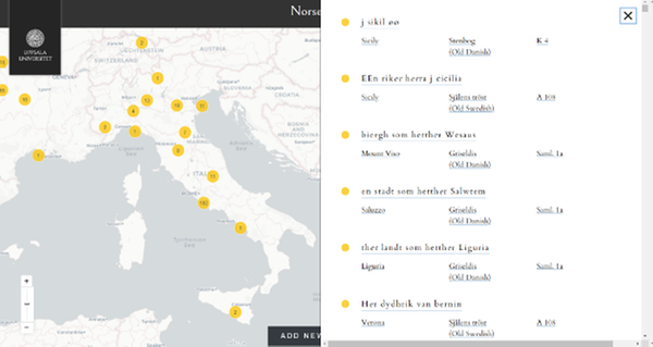
A cluster that has been clicked and its detailed view.
When you have finished, you can close the detailed view to return to the original cluster attestation list. This does not work if you have clicked on a 'Show all attestations' link which generates a new attestation list (with grey markers).
To zoom in or out you can use the + and - in the lower left corner or use the slider to zoom in more quickly.
You can switch between two underlying maps, the CartoDB and Stamen.
The colour of the search box correspond to the colour of the marker on the map and the detailed view (see 'Search and filters').